cross-posted from: https://sh.itjust.works/post/1641859
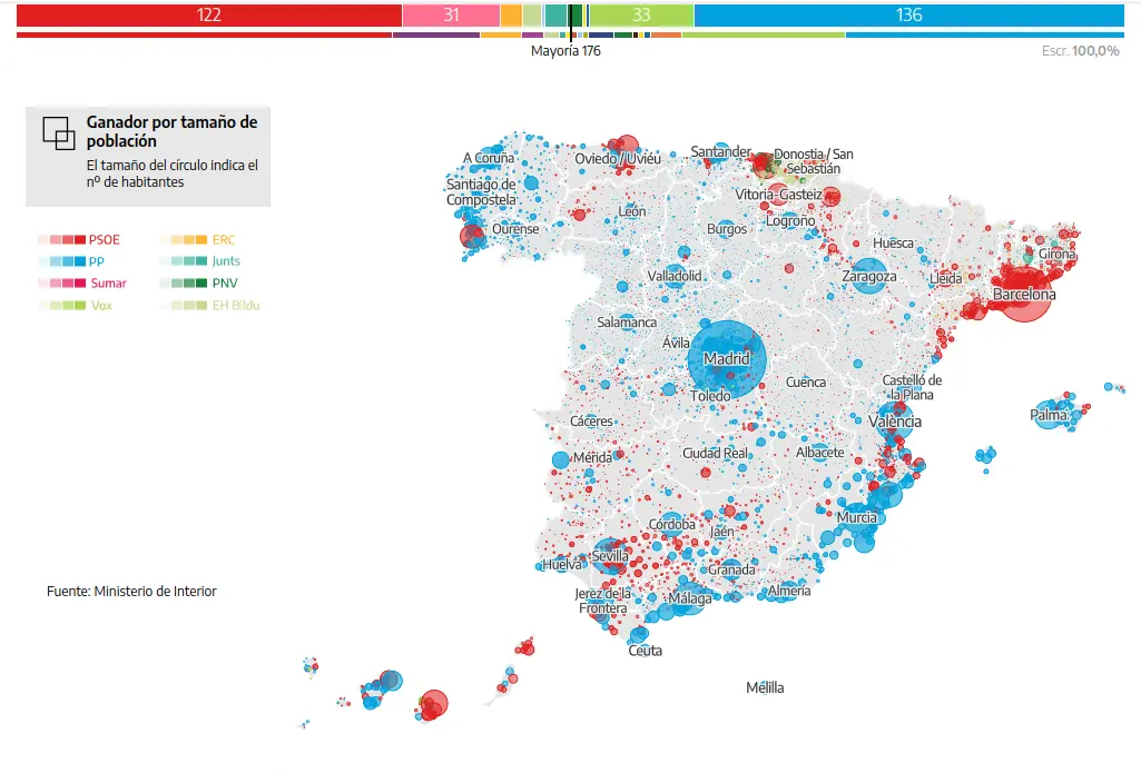
Since land does not vote, it is also useful to look at this map with population size indicated:
Taken from El Diario, with interactive maps and more: https://www.eldiario.es/politica/resultados-elecciones-generales-23j-por-municipio_1_10377802.html


Indeed, actually an interesting map on this is “Ganador por tamaño de población” (third option on the left) on https://www.eldiario.es/politica/resultados-elecciones-generales-23j-por-municipio_1_10377802.html
Basque Country still seems quite red